Vancouver Island West Coast Trail
One of the most technically demanding coastal treks in North America, following the rugged, storm-battered shoreline of Vancouver Island’s Pacific Rim over more than a hundred ladders, cable-car river crossings, and tide-timed beach sections along the historic “Graveyard of the Pacific.”
- Region
- Pacific Rim National Park Reserve, Vancouver Island
- Country
- Canada
- Difficulty
- Strenuous
- Terrain
- Deep Forest
- Distance
- 75 km
- Elevation gain
- +1850 m
- Max altitude
- 200 m
- Duration
- 5 - 7 Days
- Best months
- Jun, Jul, Aug, Sep
- Permit
- Parks Canada West Coast Trail reservation (quota-limited, official season 1 May - 30 Sep)
The trail was cut in the early 1900s as a lifesaving telegraph route after the 1906 wreck of the SS Valencia, and it still crosses the same unforgiving stretch of coast: temperate rainforest crowding right down to the sand, surge channels that must be timed against the tide table, and river crossings spanned only by hand-hauled cable cars. Mud, roots, and ladder after ladder make the daily distances deceptively short and hard-won.
Cultural notes: The route crosses the traditional territories of the Huu-ay-aht, Ditidaht, and Pacheedaht First Nations. The crossing of Nitinat Narrows is operated as a paid ferry service run by Ditidaht First Nation members, and hikers are expected to respect the cultural and environmental significance of the land they are passing through.
Wildlife notes: Black bears and, more rarely, cougars are present along the corridor and food must be stored per park regulations. Gray whales migrate offshore within sight of the trail in spring and autumn, bald eagles are a near-constant presence, and sea otters and black-tailed deer are commonly seen from the beach sections.
Key hazards
- Over 100 ladder sections, often wet and slick, with significant fall exposure
- Tide-dependent beach routes -- hikers can be cut off by an incoming tide without a current tide table
- River crossings limited to hand-operated cable cars; no fording
- Black bear and cougar activity along the corridor
Essential gear
- Stormvane fully waterproof hiking boots with aggressive tread for ladders and slick roots
- Duskdown compressible sleeping bag rated to at least 0°C
- Halcyon Ridge freestanding tent (beach camps offer no wind shelter)
- Trueflame backpacking stove (open fires are restricted at many sites)
- Northlatch handheld VHF radio or satellite messenger -- cell coverage is essentially absent
- A current tide table for the region, carried in a waterproof case
- Bear-resistant food storage per park regulations
Waypoint-by-waypoint
| # | Waypoint | Dist. | Elev. | Notes |
|---|---|---|---|---|
| 1 | Pachena Bay Trailhead | 0 km | 10 m | Northern trailhead near Bamfield; mandatory orientation session before departure. |
| 2 | Pachena Point Lighthouse | 9 km | 30 m | Staffed lighthouse station; first of two lighthouses on the route. |
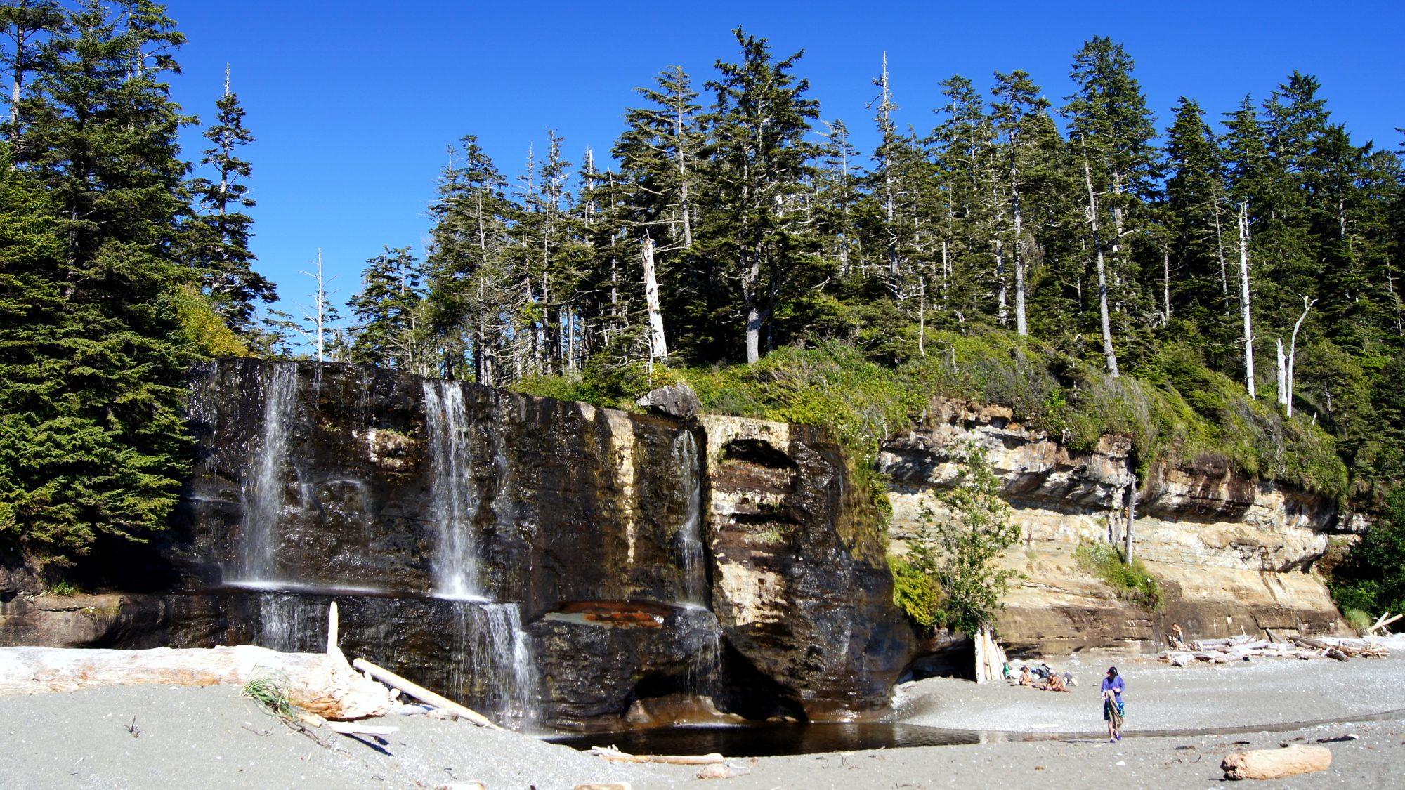
| 3 | Tsusiat Falls Camp (camp) | 24 km | 15 m | Iconic waterfall dropping directly onto the beach; the most popular camp on the trail. |
| 4 | Nitinat Narrows Ferry Crossing | 32 km | 5 m | Operated by Ditidaht First Nation; a well-known trailside stop for fresh crab. |
| 5 | Carmanah Point Lighthouse / Cribs Creek (camp) | 44 km | 20 m | Second lighthouse on the route, with a beach camp just south. |
| 6 | Gordon River Trailhead, Port Renfrew | 75 km | 15 m | Southern terminus; small boat ferry across the Gordon River to the trailhead parking area. |